The RAPID Facility team deployed sensors and drones in Florida to gather critical data before and after Hurricane Helene’s landfall.

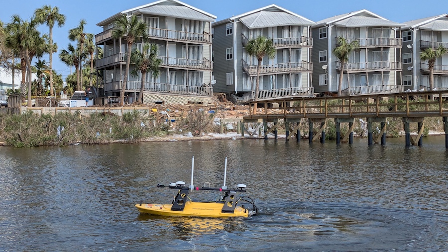
The RAPID team’s yellow Z-boat with sonar equipment floats in front of waterfront apartments damaged by Hurricane Helene, collecting post-storm data on underwater landscape changes in Florida

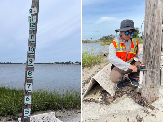
Left: A measurement post showing water levels, installed to record storm surge heights during Hurricane Helene. Storm surges in Cedar Key reached 10 feet during the hurricane. Right: Kandai Shimada, a UW undergraduate, checks a wave gauge designed to measure storm surge and wave height.
In September, the Natural Hazard and Disaster Reconnaissance Facility (RAPID) team traveled to Florida both before and after Hurricane Helene’s landfall. Collaborating with researchers from the University of Florida, the team deployed wave gauges to measure storm surge levels and wave height and used drones equipped with LiDAR — a technology that uses lasers to create precise 3D maps — to map beach fronts and coastal infrastructure before the storm.
“Wave and storm surge levels during hurricanes are often predicted based on models, so this dataset will help researchers validate and better calibrate their predictive models,” says Michael Grilliot, RAPID Facility’s operations manager.
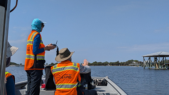
After the hurricane, the team returned to Florida to assess the damage. Using drones with specialized cameras, they captured detailed images, including damage invisible to the naked eye. They also used lidar to measure erosion and building damage and a sonar-equipped Z-boat to map changes to the underwater landscape.

Members of the RAPID team operate the Z-boat after Hurricane Helene to collect post-storm data. The team used this sonar-equipped boat to map changes to the underwater landscape caused by the storm’s impact.
The team was excited to find that their wave gauges had successfully captured data from the most active parts of the hurricane, marking a successful first deployment of these devices, which were built by Kandai Shimada, a UW undergraduate student studying electrical and computer engineering.
The combined pre-, during-, and post-storm data will provide unprecedented, high-resolution information on the effects of the hurricane. This includes the changes to the coastal environment and infrastructure, as well as the underlying mechanisms that caused the damage. Such detailed insights will help communities improve disaster preparedness and design more resilient infrastructure for future storms.
Inside RAPID’s pre-storm mission
Before Hurricane Helene made landfall, the RAPID team was on the ground in Florida gathering pre-storm data. Discover how this early data collection is helping researchers build a complete picture of the storm’s impact.
Originally published November 21, 2024