

Cultivating a campus solution
This project is not just about saving water; it’s about demonstrating our commitment to sustainability right here at UW.”
The project's origins can be traced back to 2018, when Brian Davis, a project manager at UW Facilities, learned about Hossain’s work on water management in South Asia. Hossain’s research utilized satellite data to manage irrigation for crops in regions with limited water resources, a solution that had proven successful in countries like Pakistan and Bangladesh. Inspired by the potential to apply similar technology to the UW’s campus, Davis reached out to Hossain with a simple question: Could this approach be adapted to help the UW manage its irrigation needs during Seattle’s dry summer months?
“The UW is one of the largest water users in the city of Seattle during the summer,” Davis explains. “So finding ways to reduce our water consumption is critical.”
Hossain, who had long been interested in applying his research locally, saw this as an opportunity to use the UW campus as a living laboratory.
“We do amazing research all over the world, but it’s rare to see these innovations implemented right where we work and teach,” Hossain says. “This project is not just about saving water; it’s about demonstrating our commitment to sustainability right here at UW.”
A hybrid approach to irrigation
The project uses a hybrid approach, combining broad satellite data with precise on-the-ground sensors. NASA satellites gather extensive data, such as weather patterns, precipitation levels and overall soil moisture trends across large areas. While this data provides a broad overview of irrigation needs, it can sometimes miss the finer details crucial for hyper-local applications like campus landscaping.
“At the UW, you can walk through places like Sylvan Grove and see towering trees alongside medium canopy trees, massive rhododendrons, smaller shrubs and groundcover — all in close proximity,” Davis says.
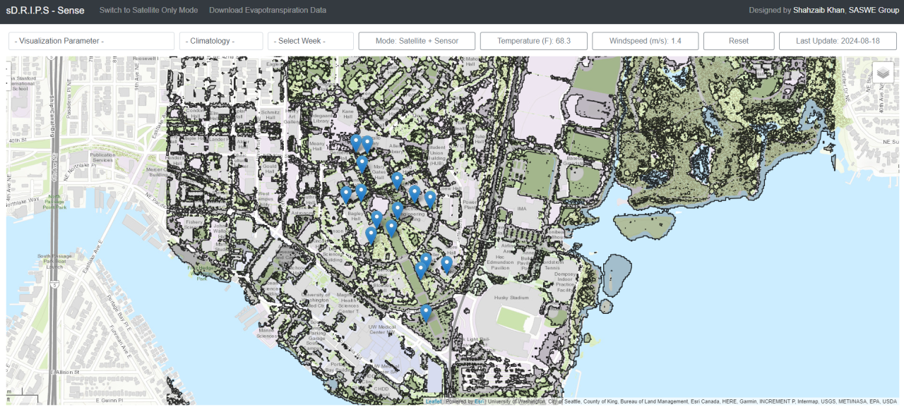
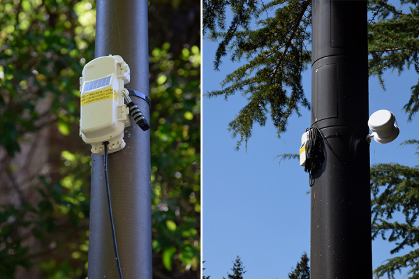
The diversity of campus landscapes makes irrigation needs too complex to address with satellite data alone. This is where the sensors come into play. Installed at strategic locations around the UW campus, the sensors measure soil moisture and air temperature in real time, providing detailed, on-the-ground data that fine-tunes the broader satellite information.
“The sensors aren't measuring everything we need to calculate what’s necessary for irrigation. A lot of crucial data comes from the satellite system,” Hossain says. “The combination allows us to use fewer sensors while still getting a comprehensive view of the entire campus. It’s about using the best of both worlds — satellites and sensors — to create an optimal and affordable system.”
The sensors used in the project are known as “hopping sensors” because of their ability to overcome obstacles like buildings and trees. Unlike typical sensors that require a direct connection to a central router, these sensors communicate with each other by “hopping” data from one sensor to the next until it reaches its destination. This feature ensures that data can be transmitted even in areas with physical barriers. This technology, provided by the project’s industry partner OnsetCOMP, is particularly well-suited to the UW’s complex urban environment.
Capstone collaboration
The system was designed and developed through the College of Engineering’s Industry Capstone Program, an initiative that brings together students, faculty and industry partners to solve real-world engineering challenges. This project was a collaborative effort between Hossain, UW Facilities, a team from OnsetCOMP — an industry leader in environmental sensor technology — and four engineering students: Andrew Line, Nathan Holterhoff, and Vincent Kwok, all from electrical and computer engineering, and Shahzaib Khan, a CEE graduate student.
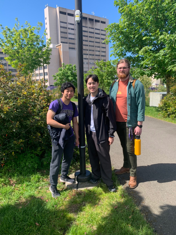
Over two academic quarters, the students worked closely with Hossain and the team from OnsetCOMP to integrate sensor data with the satellite-based model. They also developed an online dashboard and customized the system to meet the specific challenges of the UW’s diverse plant life.
Khan, who had previously worked on a similar project with Hossain, was particularly drawn to this capstone because it allowed him to expand on his earlier work and apply it directly to the UW campus.
“Previously, I worked on a project where I estimated irrigation needs for rice crops using only satellite data, and this capstone project had a similar focus. However, it provided an opportunity to advance this research at a regional scale, specifically on the UW campus,” Khan says. “It felt amazing to apply my research work right here at our campus.”
Khan’s role involved utilizing sensor data, particularly temperature and soil moisture, to accurately estimate evapotranspiration — a process where water is absorbed by plant roots, travels through the plant and eventually evaporates from the leaves, stems and flowers. He also contributed to creating the system that combined satellite and sensor data to guide the UW landscape staff in managing water needs.
“The capstone students brought a level of expertise and enthusiasm that was essential to the project’s success. They were not just participants; they played a critical role in designing and implementing the system.”
Throughout the capstone, Davis applied his facilities knowledge to help the students navigate the practical challenges of implementing the system on a busy university campus. He worked with the team to identify optimal sensor locations and ensure the sensors were not accidentally damaged by lawn mowers or other equipment.
“This is about creating something sustainable that can be integrated into our regular gardening operations,” he says.